.jpg)
Eric Reyna
Case Studies
- Positioned PaddleWays to grow from 30k → + 100k Access Points
- Designed a framework to scale an estimated 2,000 → +10,000 routes
- Aligned GIS, UX, and engineering teams around a scalable contribution model
- Positive early feedback on ease of contribution and privacy control

I worked with our GIS engineers and Subject Matter Expert Paddlers to define exactly what data we needed for each waypoint and route type. This allowed me to structure a data set template that included metadata, sub-attributes, and classification systems.

I introduced a full-screen Add Menu with three entry points, each flowing into a multi-step form.
We used conditional logic to reveal only relevant fields, avoiding form fatigue and creating an intuitive submission experience.
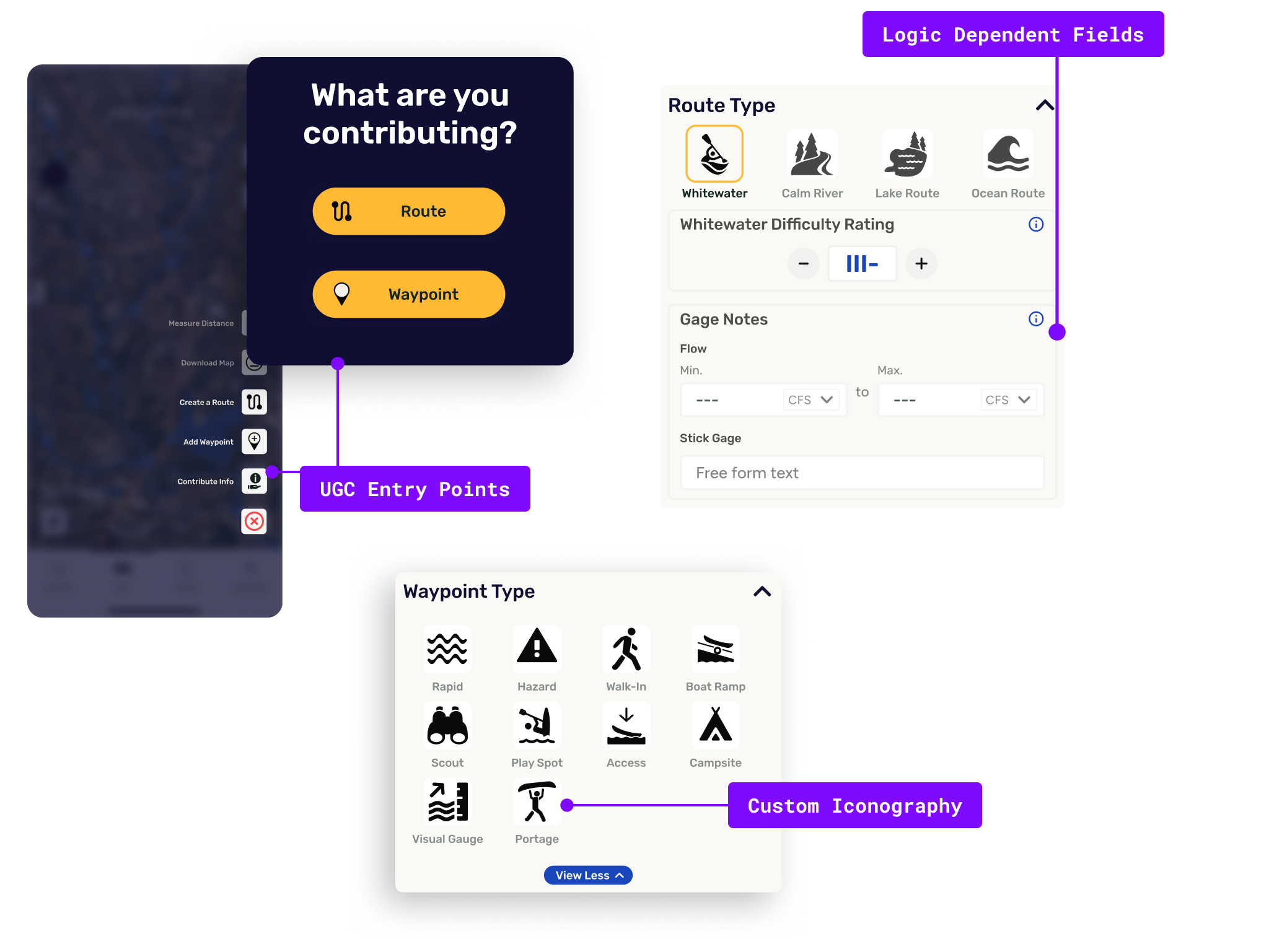
Users could log private points and routes for testing, future sharing, or personal use, lowering the pressure to “get it perfect” and helping us capture more early-stage contributions.

While route tracking was still in progress, I laid the UX foundation to support future tracking integrations.
This included early decisions around snap-to-river vs. freehand draw, route grouping, and waypoint-level editing.

This project pushed me to think like a system architect, not just a designer.
Balancing user ease with structured data integrity required tight collaboration with our SME, GIS and engineering teams.
If I were to add anything, I’d expand the UX to include contextual prompts such as asking for a photo of a stick gage when entering gage height, or surfacing a “snap a pic of the put-in” nudge while user is tracking a route. These small touches could elevate the accuracy and richness of the data while keeping the process intuitive.

